Where to Skate: Manhattan North
- Riverside Park
- Upper West Side and Morningside Heights
- Upper East Side and East Harlem
- Harlem
- Washington Heights and Inwood
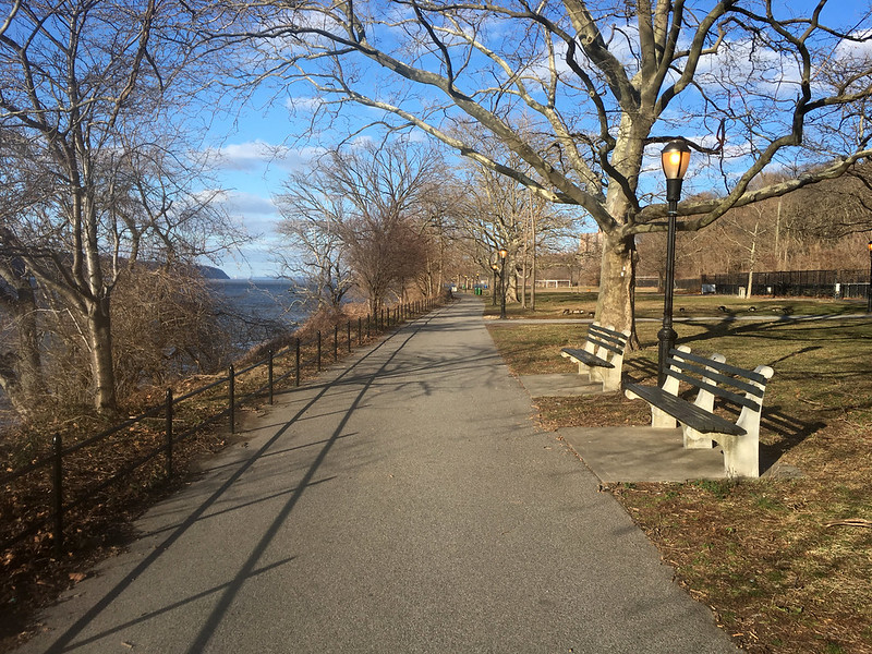
Riverside Park
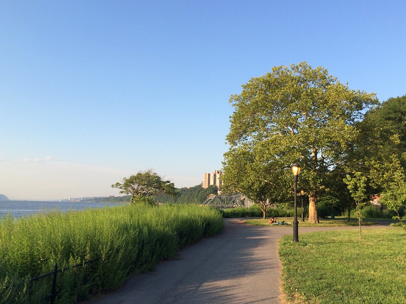
Riverside Park lies along the Hudson between 72nd St. and 158th St., with a gap in the 120s. The south section, below 125th St., might be best described as being in three tiers. The upper tier is the sidewalk promenade immediately adjacent to Riverside Dr., a walkway mostly paved with hexagonal bricks. In general, these bricks are pretty worn and the skating is bad.
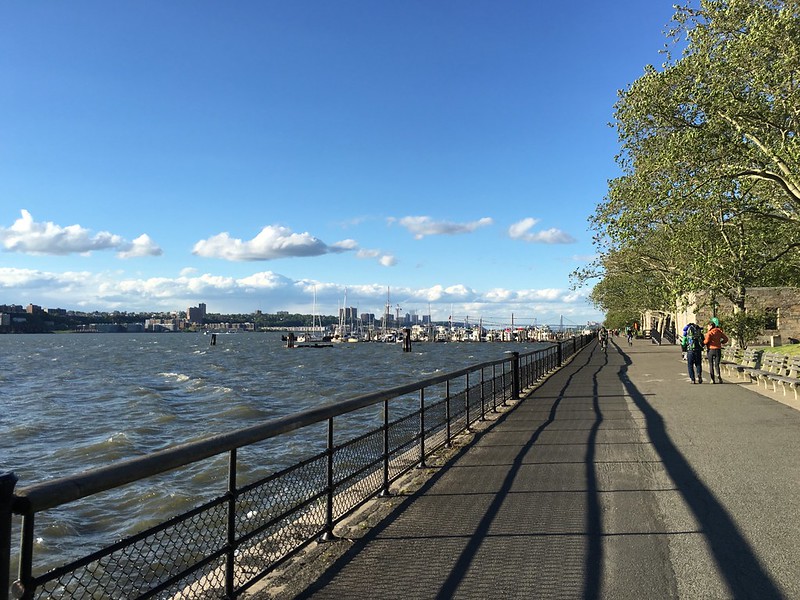
Riverside Park promenade in the 70s

Riverside Park promenade in the 80s
Along the west side of the upper tier the land drops off sharply and in many places, it's essentially a cliff. Below this drop-off is the middle tier of Riverside Park, perhaps the widest of the three tiers and probably the most used. There are various walkways and paths winding north-south, and in general, the skating here is okay.
The middle tier inthe 100s and 110s tends to be quieter. However, the main walkway hasn't been re-surfaced in years, so the asphalt is a bit rough and chewy at spots. Some side paths have been re-surfaced within living memory and are fairly smooth, but they also tend to get covered in sand and/or tree clutter. South of 96th St., the promenade between 83rd St. and 92nd St. is recently re-paved and sweet skating, but thus are can be busy with pedestrians, baby carriages and loose dogs. (Note: When crossing 96th St. between the sections, it is easier and safer to take the Riverside Dr. overpass rather than follow park paths and try to cross 96th itself, which is also an on/off-ramp from the Henry Hudson Parkway.)
The lowest tier of Riverside Park is a strip level with the Henry Hudson Parkway and the Hudson River. To the south, it is mostly between the river and the highway, but there is an area in the high 90s and through the 100s where this tier also extends east of the highway and includes ball fields and such. The Riverside Skate Park lies in this area at about 108th St.
Immediately alongside the river, Riverside Park has a promenade/path which runs down to connect with the north end of Hudson River Park at 59th St. (from whence you can skate all the way down to Battery Park City) and up to St. Clair Place (close to 125th St. and the Fairway grocery), where you can connect to the bikepath leading to the northern section of Riverside and from there all the way up to the George Washington Bridge at 178th St. As of May 2010, the promenade along the river runs uninterrupted the entire length of the park; the missing about 83rd St. to 92nd now has a cantilevered promenade sticking out over the river.
The main part of the path is the stretch south of 100th St. Here the walkway is fairly wide and reasonably allows for multiple users, but it does see quite a bit of pedestrian traffic, especially near the pier at 70th St., the boat basin at 79th St., and the tennis courts near 96th St. Barricades are sometimes put out near these places to slow down speeding cyclists. Note that the new extension of the path from 70th St. Pier down to 59th, linking up with the Hudson River Park path, is poorly lit, and sometimes part is not lit at all because lights have gone out. So while it's smooth as of this writing, it can be potentially dangerous for night skating.
The section south of the 70th St. pier mostly runs below the highway viaduct. It is relatively smooth and usually the only problem is that there are some crossings which have been lined with brick. However, this section is also poorly lit and could be dangerous if you are skating after dark and encounter an oncoming cyclist without a headlamp.
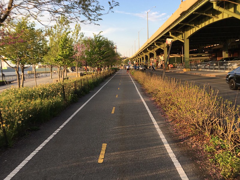
Riverside bikepath at the Harlem Piers
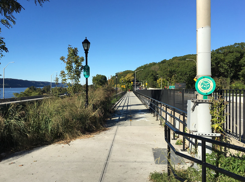
The section north of 100th St. is narrower, a bit lonelier, and at night very poorly lit. It might almost be called a paved trail. Because there is no access to the path between 100th St. and St. Clair Place, you'll see fewer pedestrians in this section, but you will have to be cautious about sand and gravel blown across the path, the occasional broken bottle, and also some bumps which can be pretty threatening. It's also pretty noisy from the adjacent highway. Once you've reached St Clair Place, you can keep on skating on the path through the new Harlem Piers park, and then along the bikepath below Riverbank State Park to reach the northernmost piece of Riverside Park starting at 145th St.
You could probably surprise many Upper West Siders by telling them that there is a section of Riverside Park that extends all the way up to about 158th St. Nevertheless, there it is. Basically, the strip of green by the Hudson River alongside north of Riverbank State Park is considered part of Riverside. It has a mostly good path and decent views. The only problem is that on nice days, part of this park area in the high 140s can be jammed with folks barbecuing, making the path a bit of dodgy affair. This busy area is also where the pavement is roughest.
To reach the northern section of Riverside from the south, you can skate up the bike path from the corner of 135th St. and Twelfth Ave., or from 125th St. and the river. Alternatively, you can walk down the covered stairway located in the northeast corner of Riverbank State Park.
In the middle, there is a new (as of September 2017), pedestrian bridge and ramps to Riverside Park that is accessible from the corner of Riverside Drive and 153rd St. From the north end, the park is accessible from the parking lot on Henry Hudson Parkway at 151st St. or, even better, the paved path lthat leads to Fort Washington Park.
Upper West Side and Morningside Heights
The avenues of the Upper West Side are usually in generally good condition, with Broadway tending to be the most variable. Central Park West has a bike/skate lane running northward the entire length of Central Park, while Columbus Ave. has a bikelane running south from 110th St. to 77th. A bikelane along Amsterdam from 73rd to 107th was installed in 2016.
In general, CPW is probably best for northbound travel, especially since the bike lane was marked in late 2001. Amsterdam is also good for uptown travel, esp. about 79th St., but watch out for the cabbies timing the traffic lights. Below 86th St., Columbus is good for going south, but north of there it is hillier and as of early 2017 the pavement not so great. If you're on Broadway, beware the dangerous "bow tie" intersections at 65th and 71st Sts..
Upper East Side and East Harlem
When travelling up and down the Upper East Side, we have found that the bikelanes on First and Second Aves. provide the best skating. Be careful using Fifth Ave., as long segments of it are curb-to-curb traffic.
Carl Schurz Park
Between East End Ave. and the East River at 86th St., this park has some very skateable paths and some very unskateable paths. There is one large open asphalt area where a lot of the neighborhood kids play rollerhockey; the asphalt was laid down in late 1995 or early 1996 and is in good condition. Dog-walking is a major activity here, so keep your eyes open.
Stanley M. Isaacs Park
This park at East 96th St. and First Ave. includes an outdoor rollerhockey rink, with renovation of the rink completed in late 2000. Although this location has long been something of a hockey hotbed, it suffered in the late 1990s because the Parks Dept. had been letting conditions at the park slide. With the renovation and the maintenance program being set up by the Isaacs Park Association, skating action here should return to its former glory and hopefully stay that way for a long time to come.
East River Esplanade
Lying between FDR Drive and the East River is the East River Esplanade. It extends from just north of the Queensboro Bridge north to the Triborough Bridge, which is to say, from 63rd St. to 125th St. In addition to various pedestrian walkways over the FDR connecting the esplanade to the UES neighborhood, but the path can also be accessed at street level at the East River 60th St. Pavilion, at Gracie Square (East 81st St.) and through Carl Schurz Park, and at East 96th St. The name "East River Esplanade" is not the official name of the promenade; from 63rd St. up to Carl Schurz Park it is the John Finley Walk, and northward of the park it is the Bobby Wagner Walk.
The esplanade is primarily surfaced with hexagonal pavers and is more or less skateable. One exception to this is right next to Carl Schurz Park, where the bricks are pretty worn and bumpy. Also, as of late 2015, there is some sort of work being done on the segment around the big 80th St. stairway, and at this point you may need to detour inland for a few blocks. Also, the grooved cement slope providing access to the 63rd St. end from 60th St. does some wicked work on your thigh muscles, so it may be safer to enter/exit on the south end via the pedestrian overpass near the hospital at 63rd St. Other trouble spots are the 60-step stairway at 80th St. and some places in the 110s where light repairs are needed. Finally, the promenade can be a bit narrow south of 81st St.
Because FDR Drive separates much of the East River Esplanade from nearby businesses or residences, it can be a secluded skate. So be cautious about skating it alone after dark.
There is a pedestrian bridge at 103rd St. which leads over to Wards Island.
Harlem
For north-south travel through Harlem, bike lanes have been marked on both sides of St. Nicholas Ave. The bikelanes start at Adam Clayton Powell Jr. Ave. and 110th St. (the north edge of Central Park) and run north on ACP to 116th St., at which point they switch over to St. Nicholas for the long run up to the intersection of 168th St. and Broadway.
Most of the avenues without bikelanes are reported as also being skateable up to 135th St., with traffic generally not too much of a problem and the pavement often better than further downtown. North of 135th St., St. Nicholas Ave. may remain the best choice. Avenues which can be a problem are Broadway and parts of Fifth Ave.
Cross streets, however, can be problematic. 125th St. is, of course, a major zoo during most daylight hours, and other cross streets south of it such as 116th St. may be used by rocketing taxis travelling between Upper West Side and Upper East. Some cross steets might be blocked by parks or large housing projects, so consult a map before skating if you're new to the area.
Harlem River Park
Bikepath in Harlem River Park
Although the concept of extending the East River Esplanade north along the Harlem River has been bruited about for a couple decades, it is taking time for the work to happen. A nice chunk has been compeleted in the middle, and some preliminary work has been done in the south.
As of early 2016, Harlem River Park runs from about 133rd St. (below the Park Ave. Bridge) up to 145th St. and includes a marked bikepath. Access is limited because of Harlem River Drive separating the park from the adjacent neighborhoods, but includes long roadside sidewalks at 135th and 139th Sts., as well as a pedestrian bridge at 142nd St. Lighting is best on the pedestrian bridge, while the 135th St. access (under the Park Ave. railroad bridge) is shadowy and seems prone to trash problems.
North of 145th St., the Harlem River bikepath resumes at about 166th St.
Riverbank State Park
Between Riverside Dr. and the Hudson River, this is not a bad place to skate, and the view of the river is pleasant. The park is built over a waste treatment facility, but I've never noticed any kind of unusual aromas here. Entrances to the park are on Riverside Dr. at 138th and 145th Sts.
Many of Riverbank State Park's walkways are paved with brick with beveled edges. Thus, even though the park was new in the 1990s, skating these walkways can be irksome. There are some extremely smooth handball and basketball courts at the south end of the park which newbies might like to skate on when they're not otherwise in use (good luck, though, as it appears that sports leagues keep them busy throughout the day).
There is a skating rink in Riverbank State Park, just northeast of the football/soccer field.
Washington Heights and Inwood
Fort Washington Park bikepath, south of the GW
See the Harlem section above for comments on the St. Nicholas Ave. bike lanes which come up to 168th St. The New Jersey section has commentary on skating to and over the George Washington Bridge.
Fort Washington Park
Lying alongside the Hudson River between 158th St. and Dyckman St., Fort Washington Park is in a sense two different parks, with the George Washington Bridge marking the dividing point between the two.
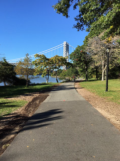
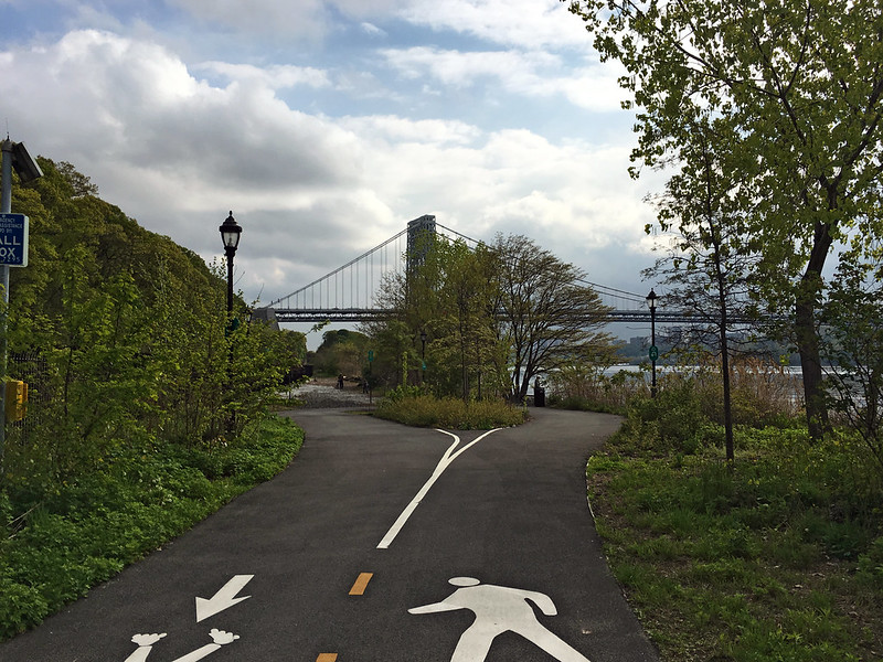
South of the GW is a strip well-favored by fishermen, tennis players, and some cyclists. Its limited accessibility would seem to preclude its use by inline skaters. However, this strip of green is a pretty place to skate, offering a 1.5-mile, decently paved path from about 158th St. up to the bridge and an absolutely gorgeous view of the river, the bridge overhead, etc. If you visit on a fall day when the leaves are turning, wow!
North of the GW, the park is essentially two long paths, a lower path at river level and another halfway up the bluff and right alongside the Henry Hudson Parkway. The lower path is a very nice skate, but doesn't go much of anywhere. The upper path does link to the path south of the GW, but the connection is tricky.
So how does one access the various paths in Fort Washington Park? There are basically three good access points. At the very south end, you can either skate along the trail that connects to the northern section of Riverside Park in the 140s. There are are two pedestrian accesses over the Henry Hudson Parkway into the neighborhood at 155th St. and at 158th St.
Upper-level Ft. Wash bikepath approaching Dyckman St.
"Dead end" on the north lower-level Fort Washingon bikepath
About 100 yards north of the George Washington Bridge, there is a pedestrian overpass that connects the park to West 181st St. near Cabrina Blvd. If you skate south, you will find that the path takes a steep, dangerous turn. Due to the tree crud on the path and potential for meeting people coming the other way, I very much recommend that you not try to skate down the path here. Instead, grab hold of the iron rail fence and sidestep down. Once you've reached the tunnel under one of the parkway lanes, you can skate along, but be prepared for a fast descent that will drop you down to river level below the bridge and near the Little Red Lighthouse.
If you skate north from the 181st St. ped bridge, you will be on the upper path of the park's north half and traveling immediately alongside the Henry Hudson Parkway. Part of this route is asphalt and part is sidewalk panels. Most of it is in good shape, but there are some spots where tree roots are causing asphalt to crack. Also, there is one spot downhill from the Cloisters museum where the path is very narrow, and because of a bit of a di[, it tends to collect dead leaves and other crud. Eventually this route leads to the northern access to Fort Washington Park, ending at a zigzag ramp that leads down to Dyckman St. below the parkway. This ramp was completed in 2015 and has made the path access many times easier than it used to be.
Also at the north end of the park at Dyckman St. is the only entrance to a lower bikepath alongsie the Hudson River. It looks like some sort of access road adjacent to La Marina, but it is actually a recently (as of 2016) smooth recreational route that leads south almost a mile. Unfortunately, at the south end, there is a just a little loop, and no connection to nothing else. The other northern access, closer to the river and alongside La Marina, is to a riverside path. It does not link up to the riverside path south of the GW.
Fort Tryon Park
This park surrounding the Cloisters has some nice paths, but most are fairly steep; no surprise, since the park includes some of the highest ground in Manhattan. Also, there are signs indicating that skating is not allowed. That said, the road from Margaret Corbin Circle up to the Cloisters is of early 2017 in great condition, so if you're in the Heights, it's worth a quick spin in and out of the park.
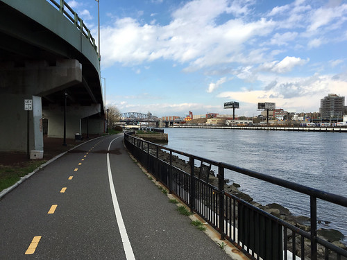
Harlem River Drive
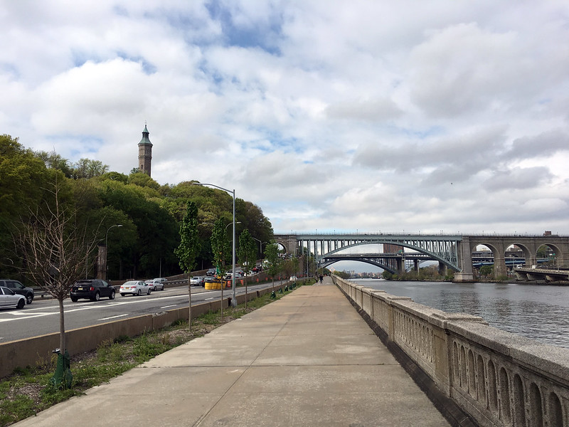
South end of Harlem River Drive bikepath
There is a waterside walk and bikepath along the Harlem River from about 166th St up to Swindlers Cove, at the threeway intersection of Dyckman St., Harlem River Drive, and Tenth Ave. Because it lies between the river and Harlem River Drive, access to the path is limited. So limited, in fact, that the only two access points are at the south and north ends.
The north access is very visible and easily reached, via the marked path, but the south access involves the sidewalk alongside the long ramp leading over the highway and all the way uphill to the six-way intersection of Edgecombe Ave, St. Nicholas Place, and West 155th St.
In the north, part the bike path is separate from the esplanade in one long stretch and is in decent condition. South of about 180th St., however, there is no separate bike path, and the asphalt condition can be a bit chewy.
Inwood Hill Park
North end of Dyckman Fields bikepath
Dyckman Fields, a part of Inwood Hill Park that lies between the Hudson River and the eponymous hill, has some nice paths. They are fairly smooth and mostly flat, but can be a bit twiggy or sandy. From Dyckman St. north to where the paths end near Spuyten Duyvil and the entrance to the Harlem River, it's about a mile.
There is also a rollerhockey rink in Dyckman Fields, but it has not been in good condition for years and seems to see little use except from people using it as a volleyball courted. A Parks Dept. master plan dated late 2008 suggests that it may eventually be replaced by a softball diamond.
To get to the park, just take Dyckman Street all the way west to the Hudson, then turn right and you're there. The rollerhockey rink is perhaps two-thirds of the way up the park, past about five soccer and softball fields.
There is also a pedestrian bridge to the park leading from the rollerhockey rink over the railroad tracks and into Inwood Hill Park proper, but the paths on the park side can be steep and in some places in bad condition. It is possible to navigate via reasonably smooth park paths from this ped bridge uphill and north to the pedestrian walkway to the Bronx on the Henry Hudson bridge. However, the route is steep.